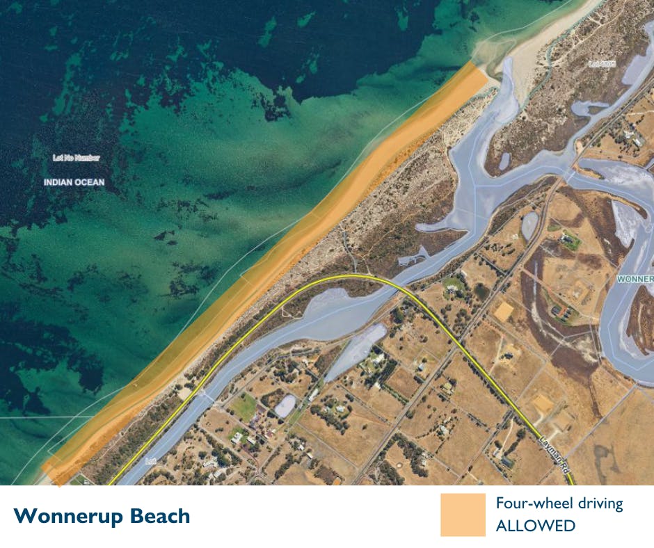
Maps
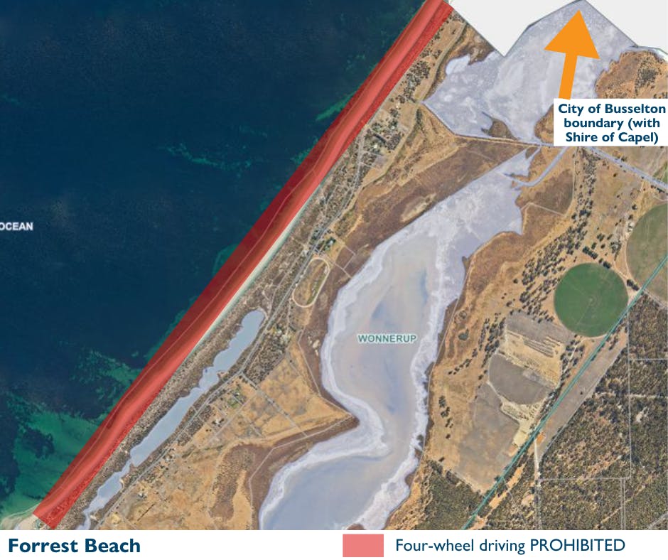
An aerial of image of the section of Forrest Beach which sits with the City of Busselton local government area, overlaid with a red rectangle to show where four-wheel driving is prohibited. An orange arrow in the top right-hand corner of the image sits above a text box which reads 'City of Busselton boundary (with Shire of Capel)'. This is show where the boundary between the two local governments is.