Coastal Adaptation Planning
Consultation has concluded
COMMUNITY INFORMATION SESSIONS
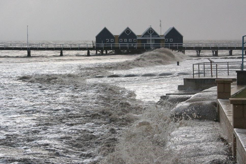
The City of Busselton is working to identify the vulnerability of our sandy coastline (Wonnerup to Dunsborough and the coastline at Yallingup, Eagle Bay, Smiths Beach and Bunker Bay settlements) to coastal hazards through a Coastal Hazard Risk Management and Adaptation Planning (CHRMAP) project.
The aim of the CHRMAP is to identify the current and potential extent of risk to private assets, public infrastructure and environmental, social and cultural values from coastal hazards arising from predicted sea level rise over a 100 year timeframe and the consequences and actions needed to meet the challenges of sea level rise.
The project is a five phase study approach –
Phase 1 established the context of the coastal environment and what our community values about our coast. The results of the community coastal values survey ‘The City of Busselton Coastal Adaptation Research’ report is available on the City’s website.
Phase 2 reviewed coastal hazard assessments, being erosion and inundation to determine what natural and built assets and their cultural, social, environmental and economic value are at risk from sea level rise over 100 years. Coastal hazard maps have been produced that show what areas are likely to be vulnerable to coastal erosion.
Phase 3 analysed coastal hazard risks against what the community values about our coastline to give a range of tolerable coastal risks.
Phase 4 will develop potential coastal adaptation options and adaptation pathways based on multiple social, cultural, environmental and economic criteria. This phase will also model broad costs associated with adaptation options and pathways, implementation and funding options.
Phase 5 will involve the preparation of a draft Coastal Adaptation Strategy which will be available for public comment.

COMMUNITY COASTAL VALUES
The Western Australian Planning Commission requires coastal local governments to prepare coastal hazard risk management and adaptation plans (CHRMAP) where existing or proposed development is located in an area at risk of being affected by coastal hazards over a 100 year planning horizon. The City has now commenced preparation of our Coastal Adaptation Strategy (based on the CHRMAP framework) and has engaged coastal management experts to assist with the technical aspects of the project. The Strategy will be a planning document that informs the community and decision makers about potential coastal hazards arising from sea level rise (such as erosion and flooding), the consequences and necessary actions. The Strategy will outline key directions for adapting to coastal hazards over a 100 year planning time-frame.
Community and stakeholder engagement is fundamental to the development of the Strategy and there will be several opportunities for you to be involved. Initially, the City wants to know what you value about the coast and what you consider important for future coastal planning, protection and adaptation. This will be done through a random general public telephone survey undertaken on behalf of the City by an independent market research company from 1 – 21 October 2018. This same questionnaire is also available below for those people who wish to opt-in to take the survey.
The community values collected by the survey will be used to develop potential coastal adaptation pathways.